
www.gemeinde-michendorf.de - Die private Webseite für die Ortsteilen Michendorf, Wildenbruch, Langerwisch, Wilhelmshorst, Fresdorf und Stücken
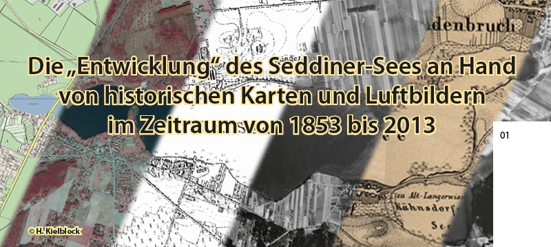
Der Seddiner See im Wandel (1853 bis 2012)
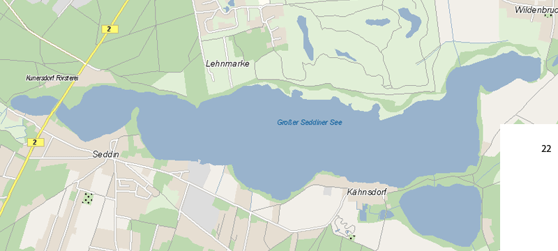
(ALK = Automatisierten Liegenschaftskarte, DTK25 = Digitale Topographische Karte 1 : 25 000)
                                |
| Anleitung ausblenden | Anleitung wieder einblenden |
Erläuterung: Ebenen
Im oberen Bereich der Ebenen sind die wahrscheinlichen und unsicheren Seeflächen positioniert, im unteren Teil der Ebenen liegen die Karten und Luftbilder
- Titelebene, Colage verschiedenster Vorlagen
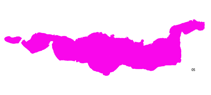
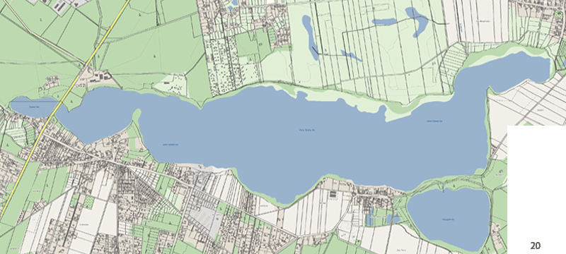
- die Seefläche, abgeleitet vom Brandenburg-Viewer (stand: 2013)
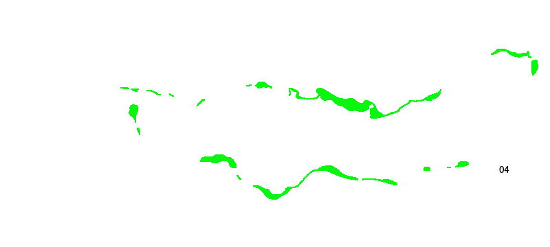
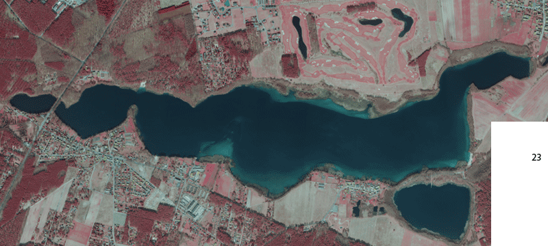
- die vermutete Seefläche, abgeleitet vom Infrarotluftbild aus dem Jahr 2012
- die unsicheren Bereiche der Seefläche abgeleitet vom Infrarotluftbild aus dem Jahr 2012
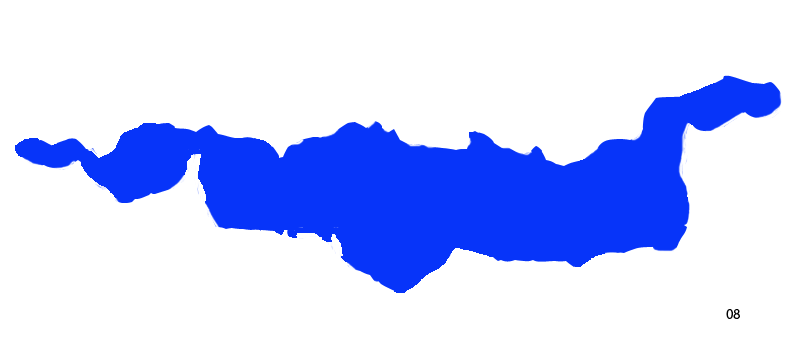
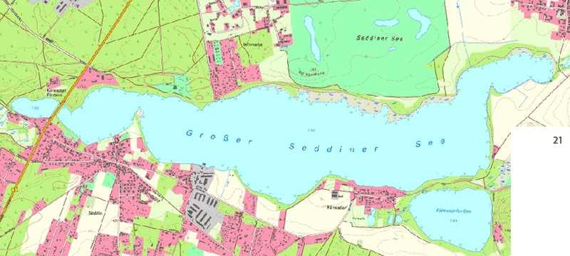
- die Seefläche, abgeleitet vom der Digitalen Topographischen Karte 1 : 25.000 vom Jahr 2005
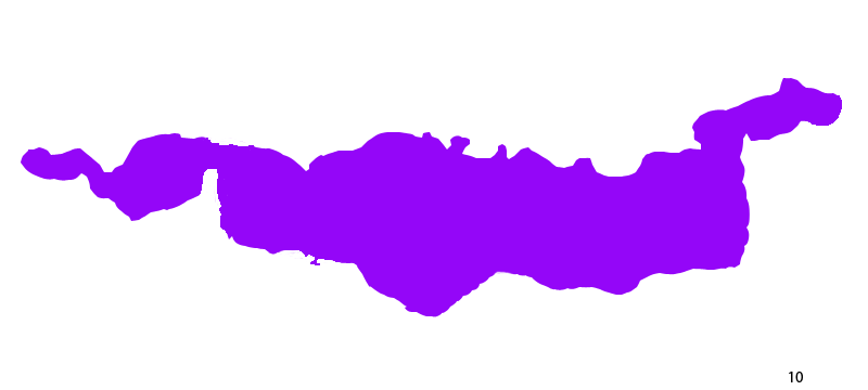
- die vermutete Seefläche, abgeleitet vom Luftbild aus dem Jahr 1991
- die unsicheren Bereiche der Seefläche abgeleitet vom Luftbild aus dem Jahr 1991
- die vermutete Seefläche, abgeleitet vom Luftbild aus dem Jahr 1960
- die unsicheren Bereiche der Seefläche abgeleitet vom Luftbild aus dem Jahr 1960
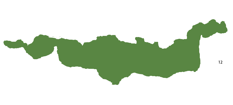
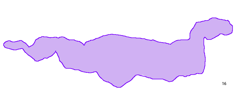
- die vermutete Seefläche, abgeleitet vom Luftbild aus dem Jahr 1953
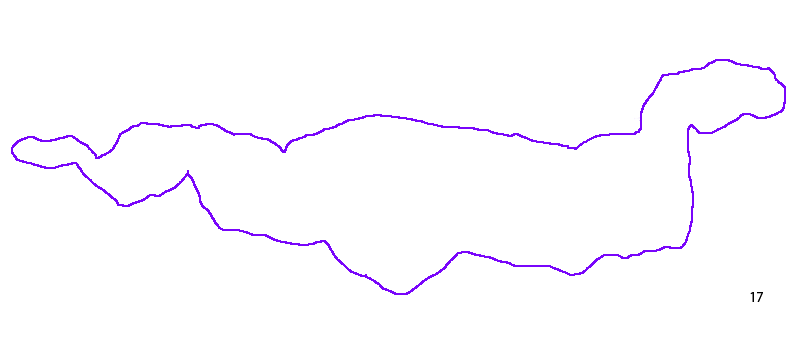
- die unsicheren Bereiche der Seefläche abgeleitet vom Luftbild aus dem Jahr 1953
- die vermutete Seefläche, abgeleitet vom Luftbild aus dem Jahr 1944
- die unsicheren Bereiche der Seefläche abgeleitet vom Luftbild aus dem Jahr 1944
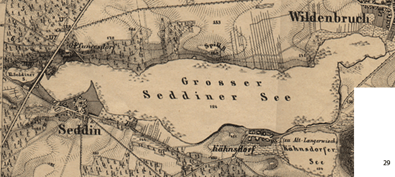
- die Seefläche, abgeleitet vom der Topographischen Karte 1 : 100.000 vom Jahr 1902
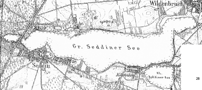
- die Seefläche, abgeleitet vom der Topographischen Karte 1 : 25.000 vom Jahr 1867
- die Seefläche, abgeleitet vom der ALK (Automatiesierte Liegenschaftskarte) mit dem eingetragenen Grundstücksgrenzen von der Erstvermessung aus demm Jahr 1853. Die Grundstücke gingen bis zum Seeufer, somit dürften die alten Grundstücksggrenzen das Seeufer von 1853 sein.
- die vermutliche Uferlinie (nur Linie) von 1853
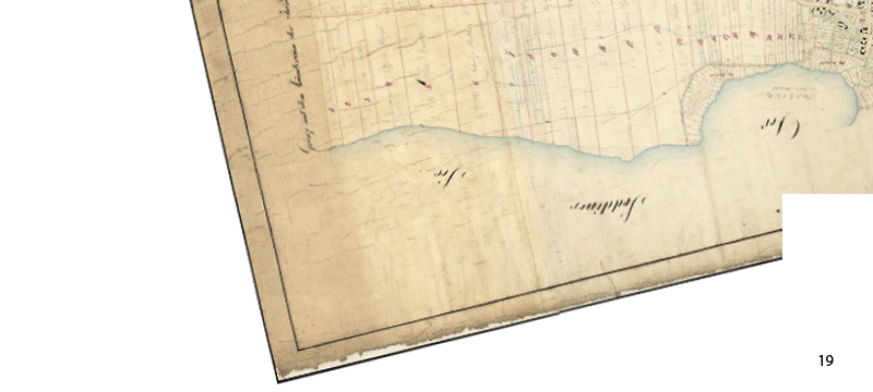
- Die historische Flurkarte Wildenbruch aus den Jahr 1853, transparent, um andere Karten unter diese zu legen
- Die historische Flurkarte Wildenbruch aus den Jahr 1853, undurchsichtig
- die ALK mit den Grundstücksgrenzen (Seeufer) von 1853 und der heutigen Situation, Brandenburg-Viewer
- Digitale Topographische Karte 1 : 25 000 aus dem Jahr 2005
- aktuelle Situation Brandenburg-Viewer
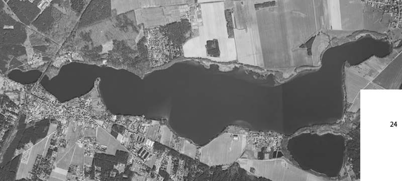
- das infrarotlicht Luftbild von 2012
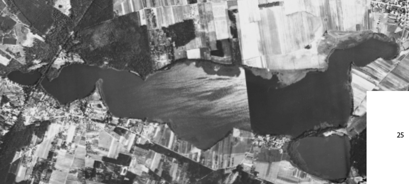
- das Luftbild von 1991
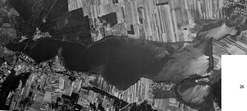
- das Luftbild von 1960
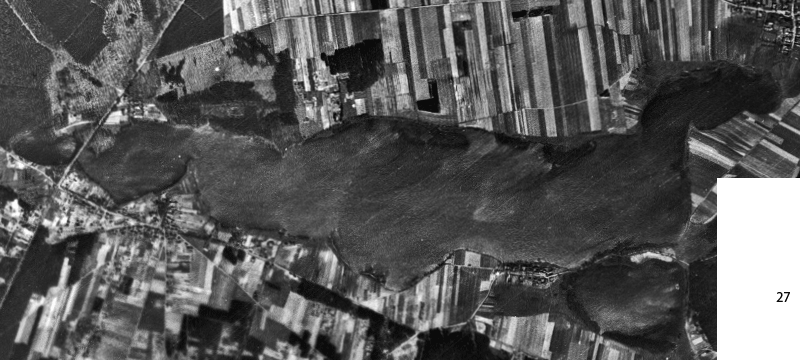
- das Luftbild von 1953
- das Luftbild von 1944
- die Topographische Karte 1 : 100 000 aus dem Jahr 1902 (Litographie)
- die Topographische Karte 1 : 25 000 aus dem Jahr 1867 (Kupferstich)
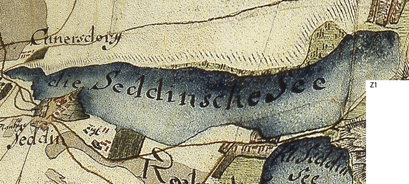
- Z1 » Abbildung der Schmettauschen Karte von etwa 1770 (Handzeichnung)
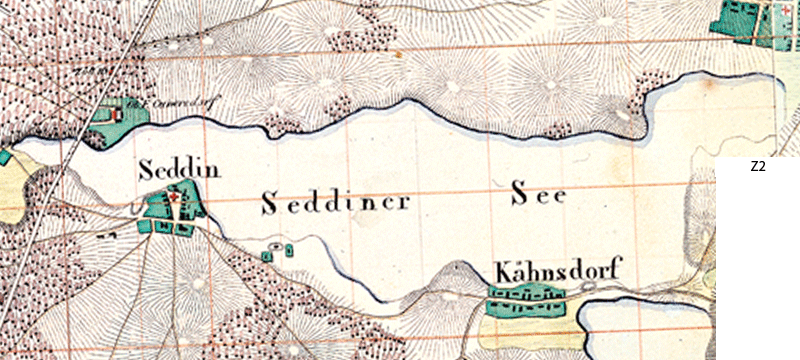
- Z2 » Abbildung der Deckerschen Karte von 1821 (Handzeichnung)
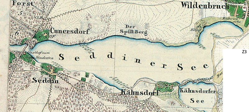
- Z3 » Abbildung des Urmesstischblattes von 1842 (Handzeichnung)
© Holger Kielblock 1999 - 2019, www.gemeinde-michendorf.de ist eine privat betriebene und finanzierte Webseite